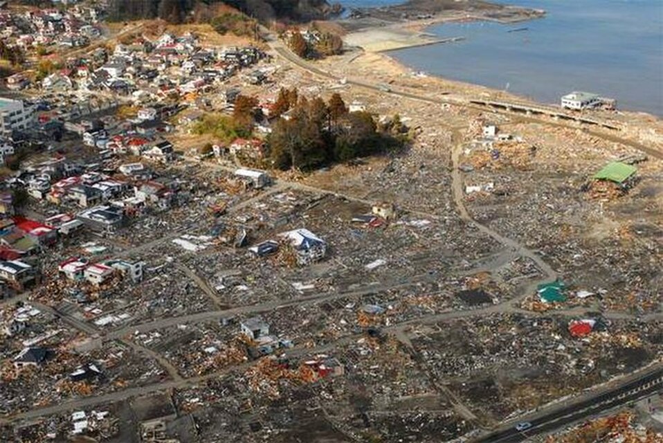
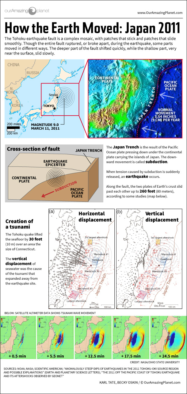
On March 11, 2011, a powerful earthquake and tsunami hit Japan, more specifically, the Tohoku province. Tohoku is the northeast region of Japan and the largest Japan island. The 2011 Tohoku earthquake hit the coastal of Japan forcibly beside a subduction zone (Oskin, B. 2017). Japan is located on the Eurasian plate boundary; this specific plate boundary is susceptible to have earthquakes. Many will ask how powerful this earthquake and tsunami was, and to answer that question, it was one of the most powerful earthquakes to have been recorded. The rupture of this earthquake shows that the fault progressed 50–60 m, and tumbled above a zone roughly 400 km long by 150 km wide (Hayes, G.P & Myers 2016). In fact, this earthquake and tsunami hit the northeastern part of Japan and caused people to become killed, damage to properties, and a nuclear crisis with regional, which caused a long-term global impact (Oskin, B. 2017). The destructive impacts are the most devastating parts of this earthquake and tsunami. Residents in Japan are still recovering from the catastrophe. In February of 2017, majority of the evacuees who lost their homes have not left the short-term housing given to them after the earthquake and tsunami took place (Oskin, B. 2017). The earthquake and tsunami negatively impacted many families, and they are still trying to recover without losing hope. After this tragedy, Japan had a short supply of water, food, and fuel which provides energy. Also, many people were unable to work because jobs were affected during the earthquake and tsunami. Leaders of the government were missing during this tragedy which left the rest of the victims of this society to struggle and reconstruct alone. There was no way out of Japan because airports were shut down, and banks had to reassemble. There was a loss of trees, plants, crops, and much more while natural gas and pollution were release. Japan, Russia, the Philippines, Indonesia, Australia, New Zealand, Papua New Guinea, Fiji, Mexico, Guatemala, El Salvador, Costa Rica, Nicaragua, Honduras, Panama, Columbia, Ecuador, Peru, Chile, and the United States were all affected by this disaster (Norio, Ye & Kajitani 2011).
This is a visual image of how the 2011 earthquake and tsunami moved.